
Sheboygan ZIP Directory Areas
Three postal designations are tied to Sheboygan in official USPS material, but they do not describe three equal residential districts. The two standard geographic delivery codes need address-level confirmation because a route can extend beyond the city line. The third is associated with post-office boxes. No authoritative source reviewed supplied a complete list of neighborhoods or out-of-city addresses for either standard code, so the table keeps that limit visible instead of drawing boundaries that the source does not support.
| ZIP Code | Areas Covered | Post Office | Notes |
|---|---|---|---|
| 53081 | Standard geographic delivery associated with Sheboygan | Confirm exact route with USPS | May extend beyond city limits |
| 53082 | Post-office-box designation | PO Box service | Not a residential neighborhood |
| 53083 | Standard geographic delivery associated with Sheboygan | Confirm exact route with USPS | Check parcel municipality |
The historical USPS Domestic Mail Manual material supports the standard and PO Box distinctions. It does not prove that every address using the preferred city name sits inside Sheboygan. For a current answer, enter the full house number, street, city, and state in the USPS ZIP Code Lookup. Then compare its result with the municipality field in the county parcel system. That two-source check is more dependable than an unofficial ZIP map.
Verify a Sheboygan ZIP
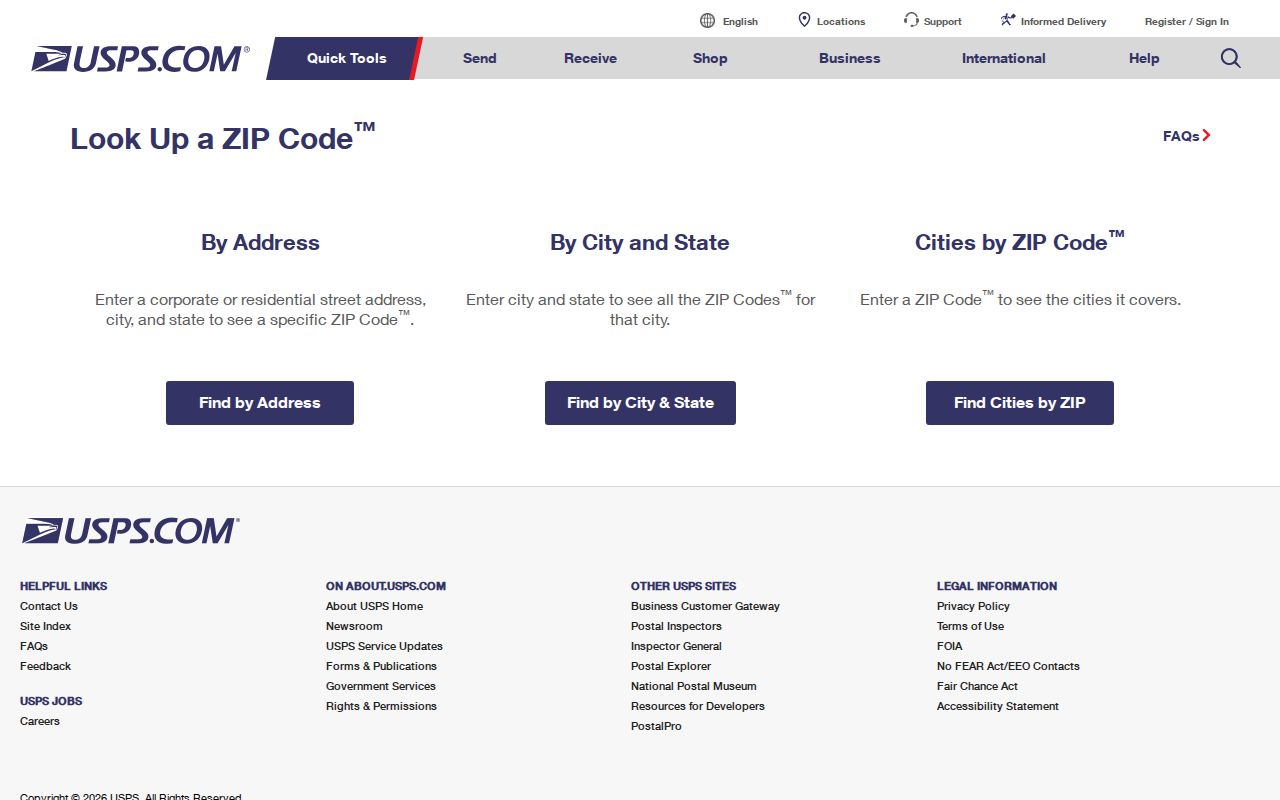
The postal lookup provides three distinct search modes. By Address is best for one property. By City and State lists codes associated with a place, while Cities by ZIP works in reverse. A result standardizes delivery information; USPS does not confirm that a named person or business occupies the address. Include an apartment or unit when several delivery points match.
| USPS mode | Information entered | Useful result |
|---|---|---|
| By Address | Street, city, state, and unit when needed | Exact delivery format and postal code |
| By City and State | City and state | Codes associated with that postal place |
| Cities by ZIP | Five-digit code | Preferred and recognized city names |
The image below comes from the official USPS lookup interface and shows its search paths.
Save the standardized address because county tax, GIS, permit, voter, and historical directory systems may handle street names or unit numbers differently.
Sheboygan Residents by ZIP
A postal code narrows an area, but local tools do not all support a broad ZIP-only resident search. The county portal documents parcel number, owner name, house number, and street searches. Its help does not confirm a ZIP field. County GIS exposes postal ZIP attributes with parcel ID, site address, municipality, owner fields, acreage, and values, but those are parcel facts rather than an occupant roll. MyVote accepts ZIP in its address workflow to return polling information; it is not a directory of everyone living in that code.
- Confirm the complete delivery address in USPS.
- Search the county land and tax portal by house number and street.
- Compare site address and municipality in the county Geospatial Hub.
- Use MyVote by address only for election information.
- Continue with the Sheboygan street directory once the street is known.
Wisconsin permits written requests for nonprotected voter-list data, and a requester can define a geographic slice. Protected details, including birth dates and confidential-elector addresses, are excluded. A ZIP-wide voter extract still covers registered voters, not every resident. For personal research, an exact address produces clearer, safer results than a large area list.
Sheboygan Parcel Geography
The county tax parcel layer is a January 1 tax-year view. Ownership updates nightly, but that layer does not show splits and mergers. A separate current parcel layer changes through the year and does reflect them. Both answer questions a ZIP code directory cannot: which municipality contains the parcel, what the mapped site address is, and whether geometry changed.
A popup may show owner names, tax mailing address, acreage, zoning, and assessed values. Keep the fields distinct. A mailing address can differ from the site address, and a tax-listed owner may live elsewhere. The service caps a query at 2,000 records, so use a bounded search.
Boundary check. Pair the USPS result with the GIS municipality field before assigning an address to a Sheboygan office or neighborhood.
Sheboygan ZIP Boundary Limits
ZIP Codes route mail. They are not legal municipal boundaries. The Census Bureau builds ZIP Code Tabulation Areas, or ZCTAs, as generalized statistical areas from Census blocks. Those areas can be noncontiguous, cross city lines, include institutional or box-only service, and differ from live carrier routes.
- ZIP and ZIP+4
- The five-digit delivery area and a smaller delivery segment.
- PO Box ZIP
- A code used mainly for boxes. Sheboygan's 53082 is not a residential neighborhood.
- Unique ZIP
- A code assigned to one high-volume organization.
- Carrier route
- Delivery points served on one postal route, not a city boundary.
The Census ZCTA guidance suits statistics, USPS supplies delivery formatting, and GIS settles municipality. A preferred postal city cannot establish residence inside Sheboygan.
Historic Sheboygan ZIP Research
Older addresses may predate ZIP service or use a street number that no longer resolves. Mead Public Library holds directories, phone books, platbooks, newspapers, and census material. UW’s digitized collection includes verified titles from 1875 through 1920. The 1884 Sanborn map can locate a building or block when a current postal search fails.
Move from the old entry to a plat, map, or legal description, then compare it with the current parcel. The Sheboygan County Historical Research Center offers paid house research using deeds, directories, photos, news, and maps. No definitive online street-renumbering crosswalk was found, so ask about a specific street and year rather than forcing an old number into a current ZIP.
Record the postal source date, spelling, parcel ID, and municipality. Those notes prevent a later boundary or portal change from looking like a conflict.
Note: Tie historical directory addresses to a period map or legal description before assigning them a modern Sheboygan ZIP.
Sheboygan ZIP Election Checks
The Wisconsin MyVote address form requires a street address, city, and ZIP, with an optional unit. Its result can identify a polling place, hours, directions, the next ballot, and absentee information for that address. That makes the code one required part of a precise election search, not a way to browse a ZIP code directory of named residents. The name form follows a different path and requires first name, last name, and birth date.
City of Sheboygan voters can use the City voter information page for the local route or call the City Clerk at 920-459-3361. County election results are kept through the County Clerk. If a public result is absent, do not assume the person moved or supplied a false ZIP. Spelling, registration status, a changed address, confidential-elector status, or form entry can explain the gap.
Wisconsin registration lists exclude protected details such as birth dates, driver-license numbers, Social Security numbers, confidential-elector addresses, and accommodation indicators. A written geographic request must respect those limits. Polling geography also changes over time, so date every result and retain the election or ward source used.
Resolve Sheboygan ZIP Conflicts
When USPS, a tax record, and a map seem to disagree, compare what each field means. USPS standardizes the delivery address. County GIS supplies the mapped situs address and municipality. The tax portal may show a different mailing address for the owner. None of those fields alone proves where an individual sleeps, receives all mail, votes, or claims legal residence.
For delivery trouble, ask the relevant USPS station about the exact address. For a parcel or municipal-boundary question, use the County Geospatial Hub or contact the City GIS coordinator at 920-459-3397. For a current tax record, search by the documented 11-digit parcel number without spaces or dashes, or use house number and street. The portal says its legal descriptions are abbreviated, so a boundary dispute may require the original instrument from the Register of Deeds.
A narrow public-record request can ask for a specific address crosswalk, parcel, document type, and date range when the portals fail. The City Clerk handles municipal records, while Mead, UW, and SCHRC are better routes for an old street form. Choosing the custodian by question prevents postal geography from being mistaken for city jurisdiction.